

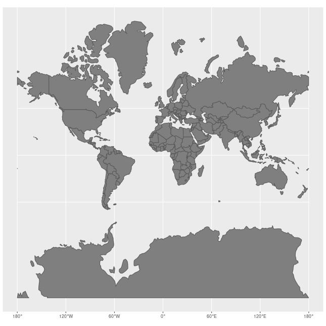
Maps lie. The Global North benefits.
And the Global South is misrepresented, again.
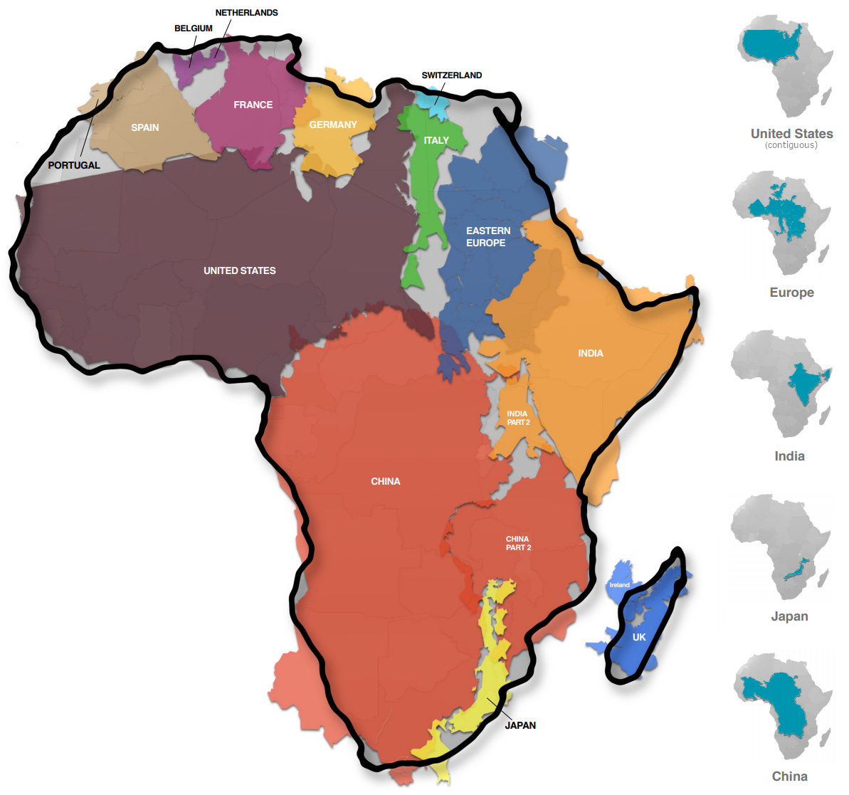
But this image illustrates the world’s actual size.
Africa (which is dramatically understated) suffers the greatest geographical injustice.
That’s because the standard world map — created by Europeans 450 years ago — is just a 2D projection of a 3D sphere. 🗺 And according to CNN, it’s no accident we still use maps with certain enlarged countries that look unnaturally intimidating.
Why does this matter?
“Maps are marketing. Assigning importance, influencing emotions, paving the way for geopolitical ambitions,” says Rebecca Wear Robinson.
(And international funding.)
In other words, it’s yet another way of perpetuating the weak Global South stereotype.
“Maps are a big deal for children in many African schools,” Ayo Adene testifies. “And I learnt the wrong maps. In fact not just geography but nearly everything... tended to present the world inversely from reality, and to diminish what needed emphasizing.”
Let’s go deeper. ⤵
The maps that prevail today have ingrained themselves in our minds since the days of the British Empire, explains Marianne Franklin, professor of global media and politics.
“They continue despite many challenges to their fairness and accuracy because they underpin the ongoing Anglo-Euro-American presumption that the world belongs to them, and pivots around these geo-cultural axes.”
So, I often write about how words matter.
But images matter just as much.
Because a lot of our conventional wisdom is old and biased.
That’s why — much like this warped map — some of our nonprofits unknowingly propagate warped narratives. And that’s why — if we see the world through this distorted storytelling — we risk creating distorted brands.
But we have the power to fight these entrenched perceptions.
Our messaging and images can either inflate Eurocentric norms. Or question them and pave the way for a more inclusive future. So we must tell our stories like cartographers of the 21st century.
Let’s ensure our fundraising strategies reflect the world as it is — not as it was perceived 450 years ago.
Let’s redefine our brands to give proper representation to those we serve.
Let’s redraw the map and — with it — our narratives.
Challenge history.
Distort no more.
💪🏽💛
The daily bonus
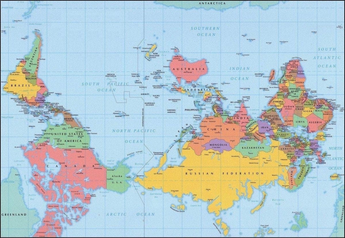
A few additional maps that just might change how we view the world. 👇🏽
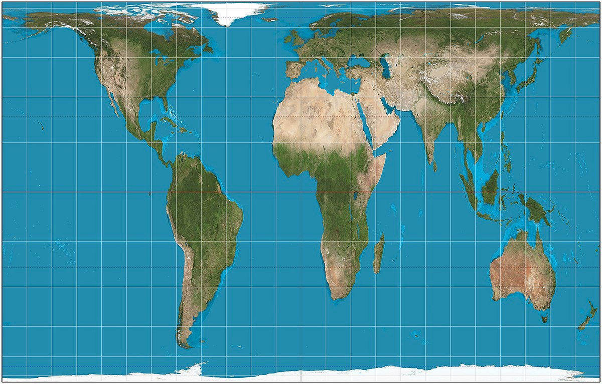
“By incorporating the Peters projection maps – an equal area representation – into classrooms, we are opening the door for students to view the world in a different light.” — Natacha Scott, Boston Public Schools
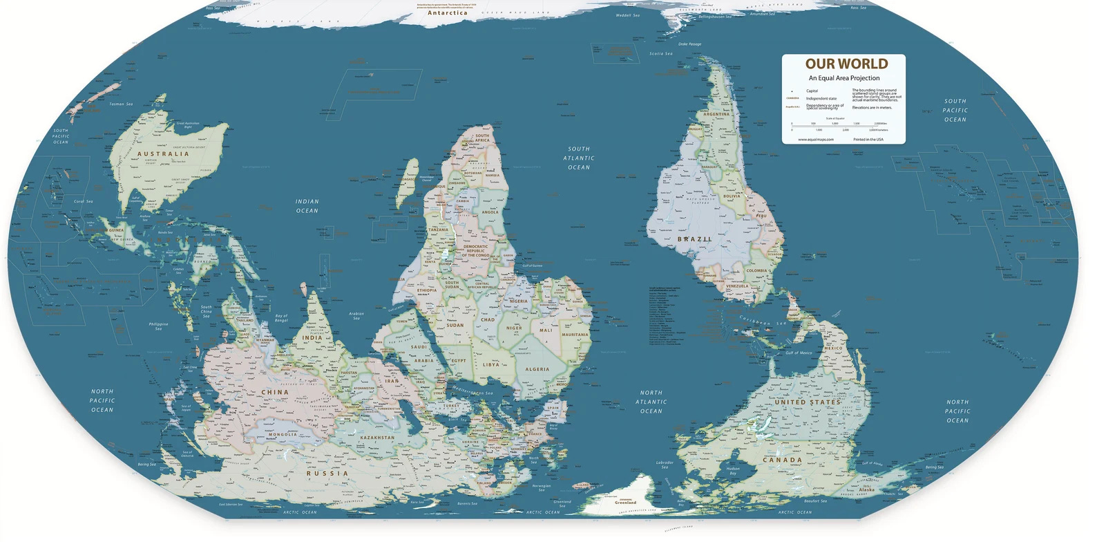
“North is up, right? Only by convention. There’s no scientific reason why north is any more up than south. Equally, we could do east-up, west-up or any other compass bearing. Purposefully reversing the typical way world maps are drawn has a similar political effect to using the Peters projection, putting more developing countries in the generally poorer southern hemisphere at the top of the map and so giving them greater significance.” — Donald Houston
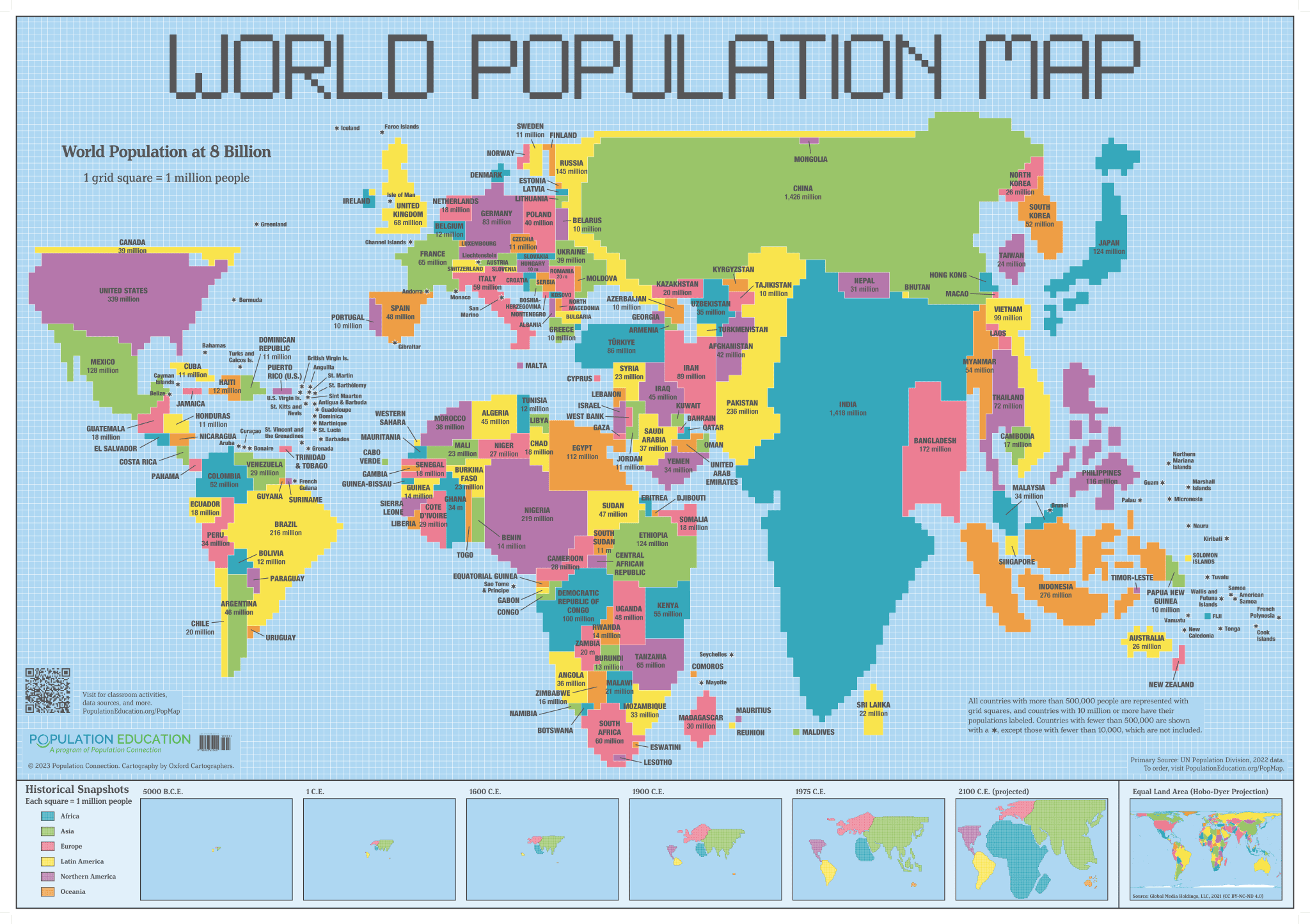
Or what if we also looked at maps based on population? How might this view change our perceptions of the world's "super powers"?
Sneak peek
Coming up in tomorrow’s newsletter:
In fundraising communications, different beats better.
“It’s not enough to be the best at what you do,” says Jerry Garcia. “You must be perceived as the only one who does what you do.”